Download Block Analysis, panel 1
Download Block Analysis, panel 2
Download Local Urban Code (LUC)
Urban codes are rules established by urban designers to guide and control the work of all those who will animate the building process in urban areas which are subjected to the code. Form-based codes are a recent attempt to shift from the control of uses and quantities to that of the space (form) of the urban fabric. In this latter case, it is assumed that uses may change continuously within roughly the same form, for example a former monastery can be turned into an army barrack and then a school and then municipal offices and then a market…
The problem with form-based codes is that they tend to be flattened into form-controlling “machines” that do not reflect as much anything really local as the personal assumptions of the professionals who created them. They tend, in short, to be too abstract. There is only one way to escape this trap: to base the formation of the code on an extensive analysis of existent elements. This is the scope of the Block Analysis.
BLOCK ANALYSIS.
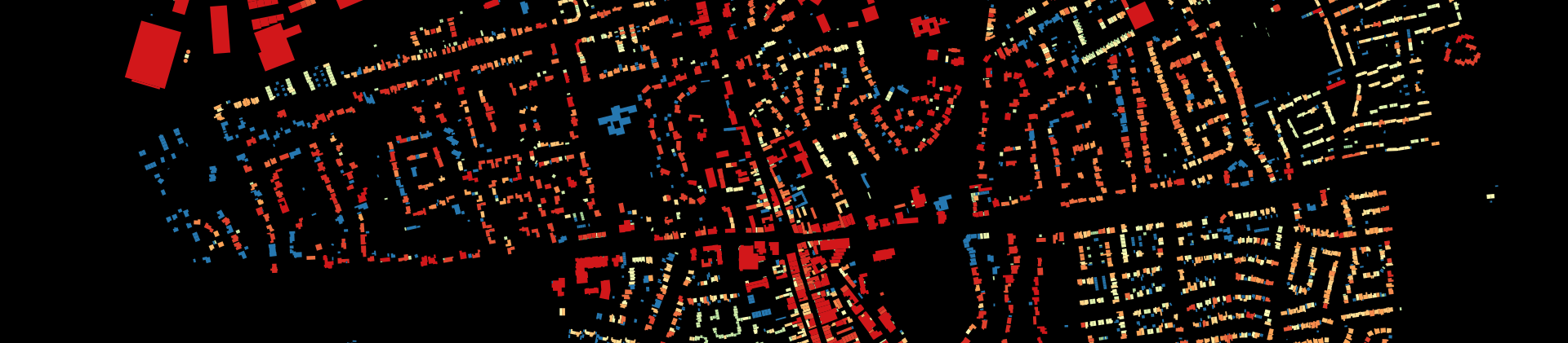
Students elaborated the morphological analysis of 29 urban blocks in Govan and Glasgow. Block Analysis is about measuring and comparing urban blocks. Blocks are selected by staff in representation of a range of combined different options based on density, land-use and building type. This organizational framework, or Local Transect, is structured as follows:
01_HIGH DENSITY
01.A. Mixed Use
01.A.a. Aggregated
01.A.b. Isolated
01.B. Mostly Residential
01.B.a. Aggregated
01.B.b. Isolated
02_MEDIUM DENSITY
02.A. Mixed Use
02.A.a. Aggregated
02.A.b. Isolated
02.B. Mostly Residential
02.B.a. Aggregated
02.B.b. Isolated
03_LOW DENSITY
03.A. Mixed Use
03.A.a. Aggregated
03.A.b. Isolated
03.B. Mostly Residential
03.B.a. Aggregated
03.B.b. Isolated
Blocks are first drawn on paper in plan, then drawings are processed in order to derive quantitative information that is stored in tables and elaborated. Some 60 indicators are calculated that allow on one hand to understand differences in the spatial structure of blocks, and on the other hand to inform the production of codes for the development of Govan based on local evidence.
LOCAL URBAN CODE (LUC)
All selected blocks belong to the following types: high, medium and low density. Within these types, we made a distinction between purely residential and mixed fabric; and again within these, between aggregated or mixed buildings:
Now, by considering values reached in real blocks by every indicator, it is easy to attribute a range of figures to such indicators as a window between two reasonable extreme values (minimum and maximum). For example, you may state that the percentage of built-up block front in one particular category (say, High Density/Mixed Use/Aggregated) cannot be less than 75% (lower limit) and may reach 100% (higher limit).
Once all categories and subcategories have been attributed a range of acceptable values for every indicator, you have the code. Because this code is developed on the ground of evidence from local cases (blocks in Govan and Glasgow from Block Analysis) we term this code the Local Urban Code (LUC).
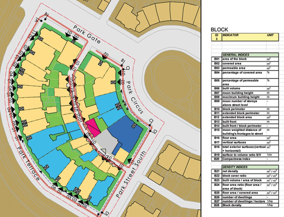
The format of the LUC is a series of A3 pages each of which containing:
- The Zone (type) name/number (for example “3Aa”)
- A plain description (for example: “low-density/mixed-use/aggregated”).
- The list of indicators;
- The range of suggested values for each indicator;
- Two exemplary blocks drawn from the Block Analysis;
- Essential information on the blocks (district, address, presumed age of construction, notes: specificities and particularities);
- The same list of indicators as in point 3;
- The value that each indicator holds in that case.