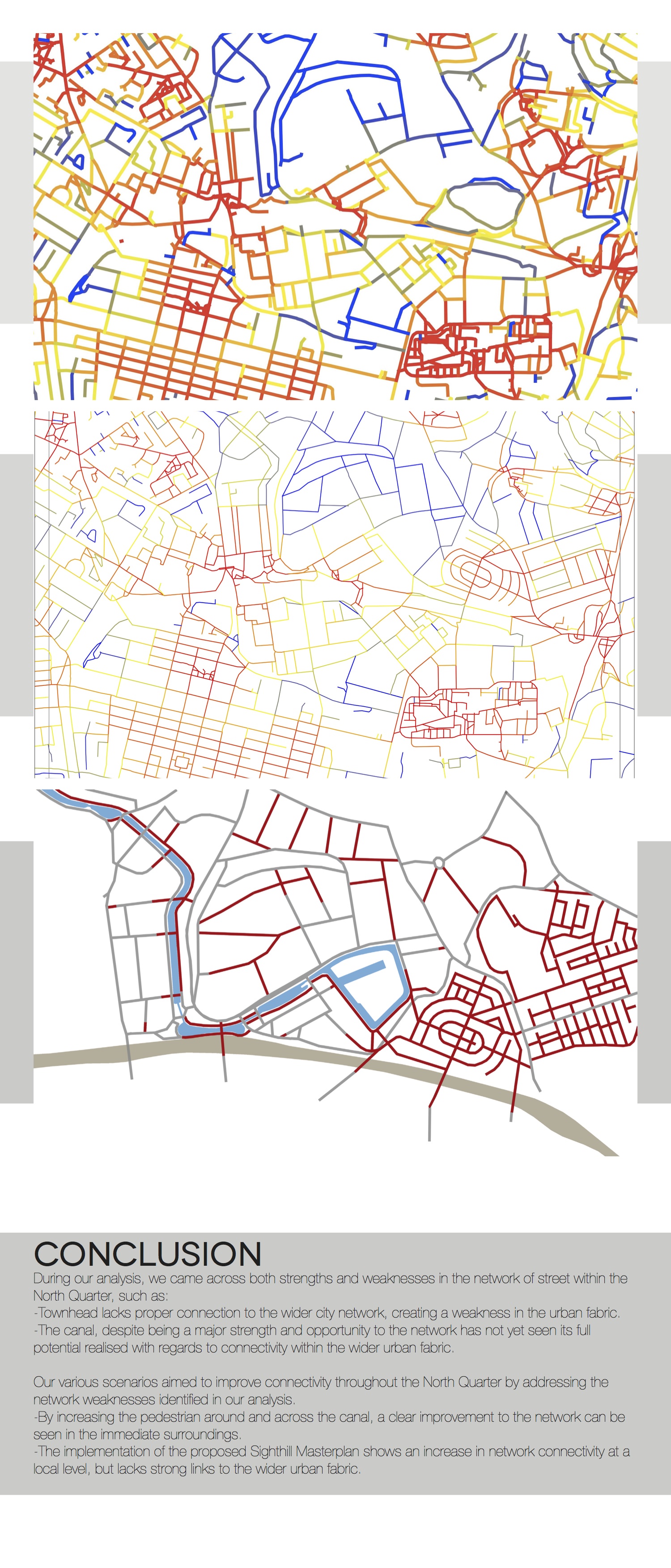
Centrality is fundamental in understanding the potential of places in every urban environment: it holds a crucial role in determining the popularity of urban places and the way they are likely to evolve in time.
It can be defined in different ways, each of which determines a different geography. The Multiple Centrality Assessment (MCA) analysis allows an accurate mapping of these geographies by means of specific algorithms developed in a GIS environment.
This tool helps investigating how centrality influences many fundamental urban dynamics such as crime, traffic and land use, that are strictly linked to the formation of sustainable and liveable neighbourhoods and urban districts.
Through MCA and focusing on the study area in the context of the whole metropolitan region, it is possible to understand its current performance and model alternative scenarios of development.
Download Network Analysis of Streets: board 1
Download Network Analysis of Streets: board 2
Download Network Analysis of Streets: board 3
Download Network Analysis of Streets: board 4
Download Network Analysis of Streets: board 5
Download Network Analysis of Streets: board 6
Download Network Analysis of Streets: board 7
by
Sen Chen
Christina Condy
Tim Freitag
Elisa Salvatore
Sean Stephen