Drawing the city
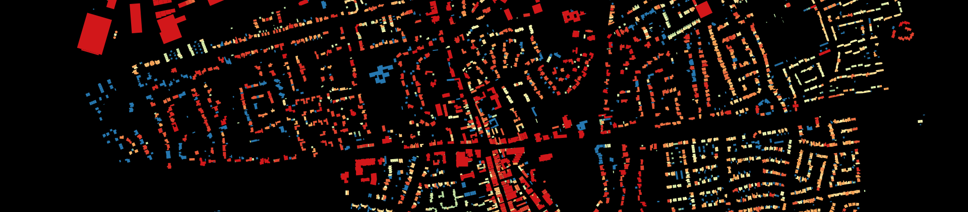
A crucial component of any urban regeneration project is achieving a deep understanding of what is already there. The first step to achieving this is to model the area’s material information as a basis to analysing the area’s more fine-grained aspects. This report presents the work carried out for the analysis brief “Drawing the Existing City” for Glasgow’s High Street and surrounding area. This includes a detailed map of the High street area along with of the key elements that make up its urban form, including aspects of its density, typology, building height, land use, etc. and site photos.
by:
Achala Karana, Keshav Goyal, Camila Nicolini, Nadeem Arshad
History and Stories
The purpose of the “History and Stories” report is to map the history of urbanisation of Glasgow’s High Street, to map the social and economic history of the area, its stories, to enable an insight into how the area has performed for its inhabitants This enabled us to form a picture over time of the morphological and developmental structure of the area by using the assembled images, maps, historical texts, interviews, and visits.
by:
Liam Byrne, Shelley Crawford, Lishan Cui, Kieran McCallion, Jordan Walker
Planning Framework
The scope of the “Planning Framework” report is to develop a clear, informed, up to date understanding of the study area as it is today in terms of its population, land uses and environmental conditions. At the same time, this analysis aims at understanding what are the ambitions of local and metropolitan stakeholders for its development. The current conditions of an area, how its parts are used, who they are owned by, what kind of environmental work is required to maximise their value, is fundamental because they reveal the strategic potential of the area and suggest directions for development.
by:
Zehua Wei, Stephen Herraghty, Jialu Qiu, Liying Qian
Experiencing the City
“Experiencing the city” is a two-phased analysis: one is about experiencing the place, and is composed of a study on the perceptions of inhabitants, whilst the other is about comparing the study area with other examples. The theoretical background of the first phase of this report, is Kevin Lynch’s book “The Image of the City”, where he introduces the mental maps, five elements forming these maps, and the terms including legibility and imageability of a place. The second phase is more quantitative and objective, as it comparing areas in terms of their connectivity and accessibility.
by:
Sanaa Bouziane, Tarek Fouani, Gill Mona, Khasim Sharif Khan Pathan
Network Analysis
The “Network Analysis” report aims to address the relationship between the street and pedestrian network and their centrality in and around High Street. Thus, the research has been conducted in two stages: analysis of the existing vehicular and pedestrian street network and “modelling” alternative scenarios. The scenarios forming the last part of the report aim to address the High street area connectivity issues and put forward possible routes for future improvement.
by:
Colm Donnelly, Giosue Gamba, Jain Subham, William Kerr