
Students: Lyndsay Pratt, Victoria Smith, Elizabeth Smith, Zarith Abu-Zahri, Roberta Bufi, Delia Schulz.
From the Brief:
“Scope:
The broad scope of this Analysis Package is to make students aware of how the study area has been developing in history to date and how that could inform its future development and make it richer and more significant for the local community and the city as a whole.
Becoming familiar with the facts and events that have shaped our city and its parts is a fundamental step in understanding how places perform and function today, the meanings and values they hold for their inhabitants, and are a critical source of information to unlock their potential for the future.
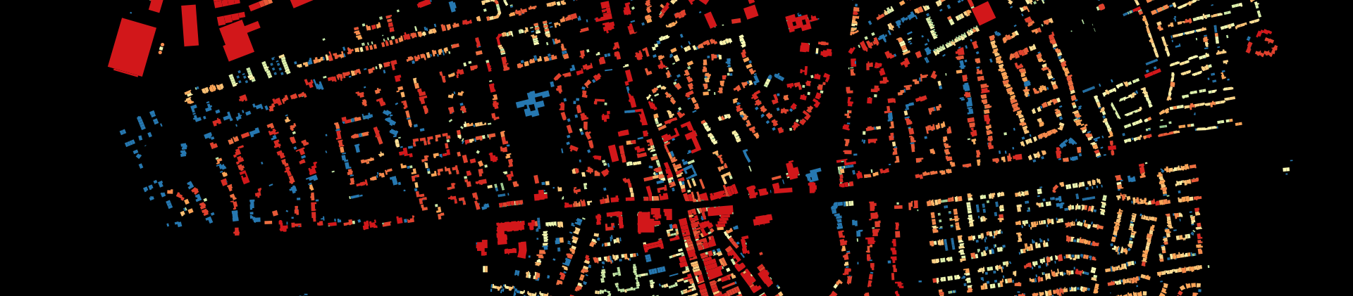
The history of a place and its form can be traced through traditional investigation of historiography sources, revealing its development since early formation through main historical periods, across economic, productive, political changes. Another useful way to understand a place, is by studying the stories which are intertwined to it, that over the years have developed and evolved, stories of life, habits, memories. Both are fundamental steps, and need to be carried out in parallel to understand the evolution of the place through time, explain its form and character today and inform decision-making on its change in the next future.
However, approaching this kind of studies within a course of Urban Design means to approach history and stories from a specific point of view, that of space. All single Work Packages (WPs) within this Analysis Package are therefore linked to one particularly relevant way of understanding, putting in reciprocal relationship and illustrating the past: mapping. This make our analytical activity, as urban designers, quite close to what geographers do, but still with a difference: we are asked to help in delivering decisions on next spatial change. It is this normative dimension that makes Urban Design what it is.
As a consequence, students working on this Analytical Package’s various Work Packages are requested to limit their focus to what in the history and the stories of Govan can be either traced on a map or referred to a mapped entity.
At the end of the work in this phase, students in this group must be able to answer 5 questions and illustrate their answers to their fellow classmates. Moreover, they should do that mainly – if not only – by means of graphic layouts. The five questions are those listed below:
- When, how and because of what did Govan’s urban fabric develop to its present form?
- What main activities were performed in the area?
- Who lived there?
- What remains today of its past (monuments, movement, landmarks, memories, images..)?
- How is today’s Govan dealing with its past (i.e. the docks, the river, undeveloped or abandoned land)?
Objectives:
- To summarize the spatial evolution of Govan’s built form in its broader context.
- To associate urban types to historic periods and modes of life.
- To report spatially specific narratives and memories through direct interaction with significant community figures and literature.
- To represent the findings as a graphic story of Govan’s past”.